9-Day Drone Audit Saved Warranty Worth Millions Before Winter Freeze
Remote Utilities Drone Inspection Detects Erosion Risk Before Warranty Deadline
Project Details
A Remote‑Community Transmission in North America. Newly commissioned (energized 2024) transmission extension delivering grid power to 17 formerly diesel‑reliant Indigenous communities.
Results snapshot:
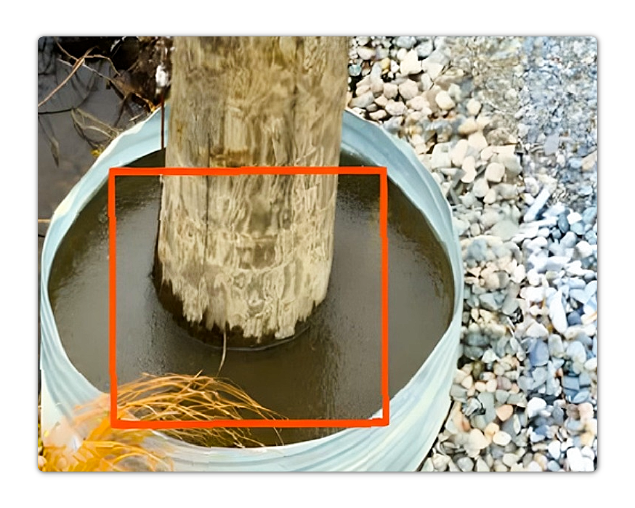
Conditions Flagged: 0 high‑risk, 322 medium, 196 low; early evidence of tower lean and flooded footings substantiated.
Avoided Impact: Warranty‑period claims prepared and submitted 2-4 days post‑inspection, enabling corrective work before winter freeze‑up and averting costly unscheduled outages.
Safety & Sustainability: Drone capture replaced the majority of ground patrols through swampy terrain, minimizing helicopter hours, CO₂ emissions, and wildlife disturbance.
Newly commissioned line served 17 Indigenous communities
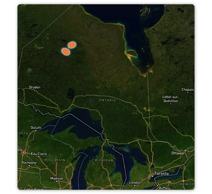
North of the 51st parallel, 17 Indigenous communities celebrated a historic milestone: escaping decades of diesel generator dependence through connection to the provincial grid. The new transmission backbone threading lakes, muskeg, and permafrost represented hope, sustainability, and economic opportunity.
But by October 2024, that celebration faced a sobering reality.
Less than 12 months was remaining on construction warranties and helicopter fly-bys had spotted concerning signs including leaning towers and flooded footings.
Photos from 300 feet couldn't provide the precision needed for warranty claims, however. Ground access through swampy terrain would take weeks and risk crews getting bogged down in muskeg as freeze-up approached.
Without definitive evidence and rapid action, costly post-warranty repairs could force communities back to diesel backup during emergency outages.
The Challenge: Faults in Impossible Terrain
Helicopter flybys failed to detect leaning towers or flooded footings
The utility needed irrefutable documentation of construction defects across 618 lattice structures spanning two transmission lines (Lines A: 286 towers, Line B: 332 towers) through some of Canada's most challenging geography.
Mission requirements:
Speed: Complete audit before warranty expiration and winter freeze-up
Precision: Measure tower lean angles and footing conditions with claim-ready accuracy
Access: Navigate muskeg, permafrost, and boreal forest safely
Evidence: Generate contractor-ready documentation within days, not months
Certain methods had already fallen short or labeled too risky: helicopter surveys lacked precision, ground patrols meant weeks of delays, and ATV access threatened crew safety in unstable terrain.
The Solution: Aerial Relay Across Wilderness
Drone Mapping Replaces Ground Patrols for Safer, Faster Inspection
DetectOS deployed a leap-frog strategy using charter helicopter positioning and precision UAV capture across the entire corridor. Operators leap-frogged via charter helicopter, landing at strategic points, launching UAV sorties, and advancing. This created an aerial relay that captured face, crossarm, hardware, and foundation imagery at safe standoff distances.
Campaign specifications:
Duration: 9 field days
Coverage: 100% of 618 structures
Data capture: High-resolution imagery (≈0.8 TB)
Team: 2 UAV operators with helicopter support
Processing: Nightly AI-assisted triage and auto-alignment
Flooded Footings and Tower Lean Confirmed Through AI Analysis
DetectOS analysis revealed systematic issues across the new infrastructure.
Critical findings included:
322 medium-severity conditions — measurable tower lean exceeding customer-defined tolerance
Flooded footings — structures visibly submerged after rainfall
196 low-severity observations — surface corrosion, hardware incongruities
0 immediate hazards — line remained safely in service
The worst news was that multiple structures exceeded design plumb tolerance, with footings clearly submerged. Had these not been spotted before freeze-up, winter repairs would have cost 10x more and risked extended outages for all 17 communities.
Time-Bound Claims Submitted with Visual Evidence in 72 Hours
Armed with this evidence, the utility lodged time‑bound warranty claims, compelling the EPC to reinforce footings before deep winter when remedial work would balloon in cost.
Total audit time: 9 days
Documentation delivery: 72 hours post-flight
Warranty claims: Successfully submitted before deadline
Emergency repairs avoided: Prevented costly winter mobilizations
Their warranty response was as follows:
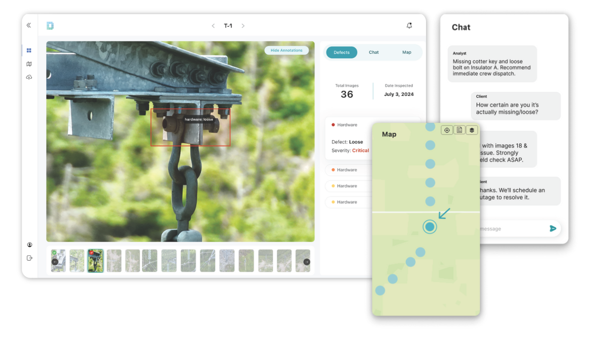
Rapid Reporting: Within 72 hours of last flight, DetectOS generated a structured defect register, complete with annotated imagery, and geolocation.
Warranty Leverage: The operator forwarded the register to the builder, meeting contractual notice periods and avoiding post‑warranty capex exposure.
Planned Remediation: Medium‑severity repairs scheduled for the following summer’s maintenance window, preventing emergency mobilizations and diesel back‑up reliance.
Results: Grid Resilience for Remote Communities
From Warranty Protection to Long-Term Utility Asset Monitoring
While the warranty benefits were substantial, the comprehensive audit delivered broader community protection:
Operational benefits:
Safety: Eliminated ground patrols through hazardous swampy terrain
Sustainability: Minimized helicopter hours, CO₂ emissions, and wildlife disturbance
Reliability: Prevented unscheduled outages that would force diesel backup
Community impact: Protected 17 communities from service interruptions during critical winter months
Risk management:
Evidence-based maintenance planning replaced reactive emergency responses
Foundation reinforcement scheduled before deep winter cost escalation
Continuous monitoring framework established for ongoing asset health
How to Audit Remote Utilities Before Time-Bound Terms
5-step playbook for high-risk terrain inspections
This playbook applies to any utility commissioning lines in challenging terrain (e.g. permafrost, wetlands, mountains) where warranty windows are short and access is difficult.
Warranty-window audit — Capture 100% of new structures before contractual deadlines
AI-assisted precision — Let DetectOS measure tower plumb and foundation conditions accurately
Evidence-ready documentation — Generate contractor packs with annotated images and quantified deviations
Risk-based prioritization — Schedule fixes by lean rate, and community impact
Continuous feedback — Refine future construction QC and footing designs
DetectOS distilled thousands of images into a concise, executive-level visual narrative. The evidence was undeniable: structural failures weren't a future risk—they were happening now.
DetectOS
Free Audit: Built for permafrost, wetland, and remote infrastructure audits
This utility had the data for years. What they lacked was evidence that stuck. DetectOS delivered that in one day—showing rot, corrosion, and imminent failure in a way that finally moved the needle. With visual documentation in place, they secured funding and launched rebuilds. Now, they’re layering in post-repair verification and long-term monitoring to make sure this investment stays strong.
In less than two weeks, this operator captured asset-level evidence across 618 towers in permafrost terrain—just in time to submit claims before the warranty window closed. The foundation erosion and tower lean detected via drone mapping could have cost millions if repairs had waited until after freeze-up. Today, their asset tracking system includes not only ongoing inspections but remediation verification.
Remote utilities don’t have to mean inaccessible risk.
Request a free audit to assess transmission foundations, prevent outages, and stay ahead of warranty deadlines, winter freeze-ups, or other time-bound challenges in your utilities ecosystem.


